



Residents who walked outside as the work week kicked off across Waterloo Region were met with what felt like toasty summer weather, warm enough to have broken some seasonal temperature records as the calendar pushes through October.
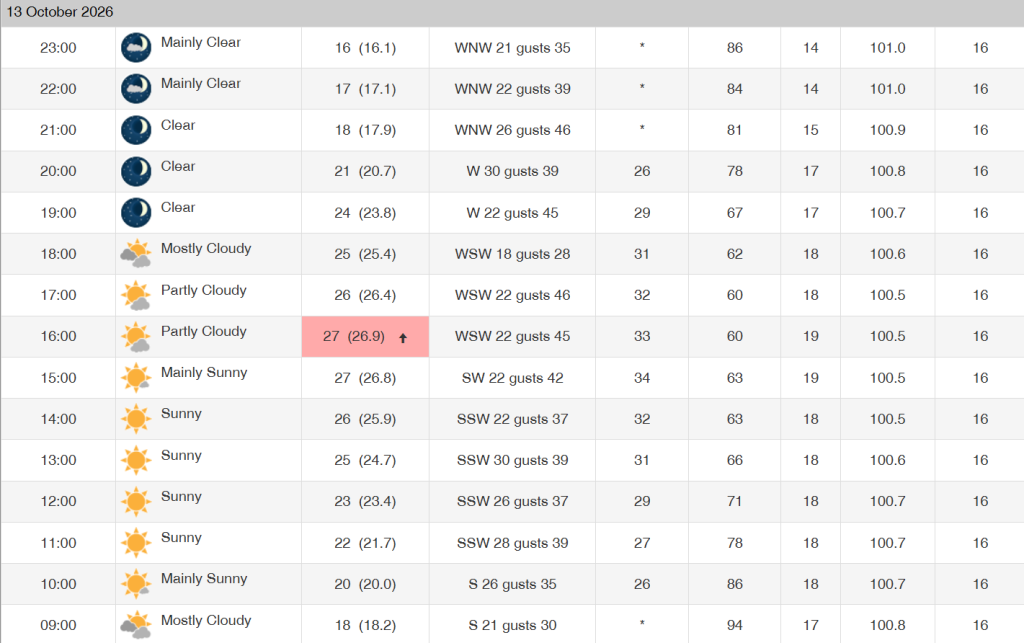
According to Environment Canada data, temperatures peaked at 26.9 C on Tuesday, Oct. 13, with humidex values making it feel closer to 34 degrees at times.
For context, on the same date since 2022, the temperature has not reached above 17 C, hitting 16.3 C in 2025 and 13 C in 2024.
In fact, the excessive warmth seen Tuesday marked the warmest Oct. 13th in close to 20 years, when, back in 2008, temperatures hit a high of 26.5 C.
RELATED:
What’s the fall forecast now that autumn has arrived in Waterloo Region?
It marked a bit of a return to what was a roasting summer across Waterloo Region in 2026, but looking ahead in the forecast, it’s not expected to stick around in the same way.
While experts continue to point to the Super El Niño weather system, which is expected to bring a warmer, drier autumn to the region and, ultimately, delay the kick-off of winter in the process, early projections show that the remainder of Fall is expected to see some back-and-forth conditions.
Experts say that overall temperatures will be warmer, but the region will see waves of cooler days intermixed with days of increased temperatures and mild conditions, making for a bit of an inconsistent autumn.
It means residents will have to prepare for all kinds of weather before the fall season comes to a close, all with October already halfway in the books and just a few short weeks left before November arrives in Waterloo Region.






Comments